Some Storms Could Turn Severe During Unsettled Stretch: Here’s Timing
The arrival of an unsettled weather pattern will be marked by rounds of showers and thunderstorms as high humidity fuels a soggy setup this week.
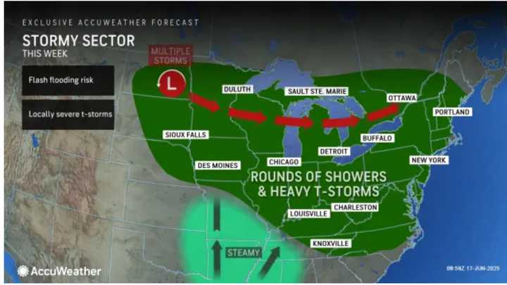
Rounds of showers and thunderstorms are expected over the broad area shown in green this week.
A stretch of warm days is predicted for Monday, June 23, through Wednesday, June 25.
With the official start of astronomical summer on Friday, June 20, a surge of heat is expected to collide with persistent wet conditions,
according to AccuWeather meteorologists.
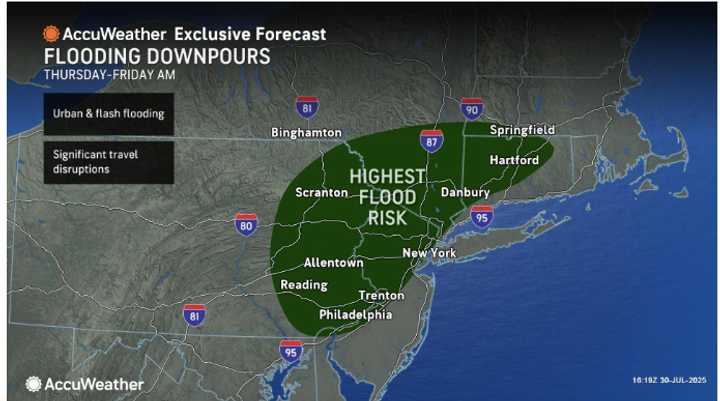
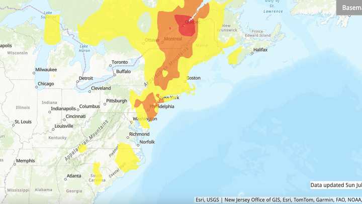
Rounds of showers and thunderstorms are expected over the next five to seven days, with potential downpours that could lead to flash flooding in already saturated areas. (See the first image above.)
“In some cases, the downpours can persist and be so intense as to lead to dangerous flash flooding,” AccuWeather says. “While it will certainly not rain constantly, there will be episodes when it rains for several hours and often enough to spoil outdoor work and recreation activities in much of the Northeast.”
Tuesday, June 17 will be cloudy, with scattered showers and light rain possible, the National Weather Service says.
Precipitation is expected to become more widespread on Wednesday, June 18, and on Juneteenth, Thursday, June 19, with scattered showers and thunderstorms during the day and again at night.
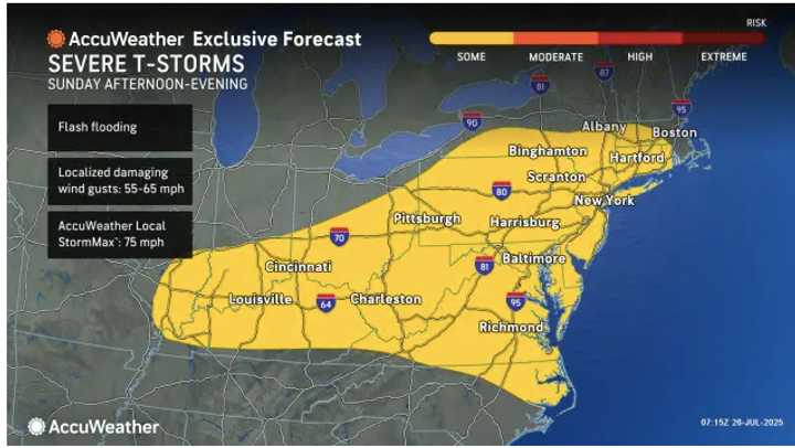
Some of the storms could turn severe, bringing heavy rain, especially on Thursday as conditions will be steamy. Strong wind gusts are also expected.
The long-range forecast predicts a stretch of warm days for Monday, June 23, through Wednesday, June 25. (Click on the second image above.)
Check back with Daily Voice for updates.