Cold Front To Unleash Severe Storms, 60 MPH Gusts: Here’s Timing
A cold front will collide with a steamy air mass, bringing thunderstorms, some of which could be severe.
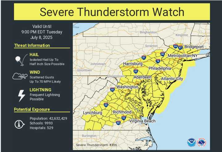
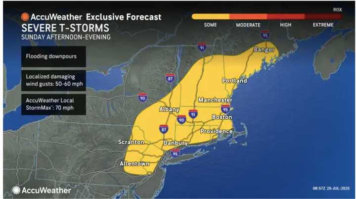
Wind gusts could be as high as 60 mph in the locations shaded in yellow.
Isolated to scattered storms are expected to erupt after 2 p.m. Sunday, July 20, and intensify toward dusk.
Any storms may produce locally strong to damaging wind gusts of around 60 mph, according to the National Weather Service. Heavy downpours are also possible.
A few of the heavier cells may also dump torrential rain in short bursts, briefly reducing visibility on busy getaway routes along the I-95 corridor.
While hail and isolated power outages can’t be ruled out, meteorologists stress that the severe threat will be hit-or-miss rather than widespread.
It will be a cloudy and hot day Sunday, with the heat index in the 90s. But as the storm system moves through, dew points will drop dramatically and it gradually will feel more comfortable.
Conditions become pleasant on Monday, July 21, with mostly sunny skies, light northwest breezes and seasonable highs in the low 80s.
Look for more of the same on Tuesday, July 22.
The mercury will climb into the upper 80s on Wednesday, July 23, but it will remain dry.
On Thursday, July 24 temperatures will hit the 90-degree mark for most of the Northeast amid plenty more sun.
Check back to Daily Voice for updates.