Erin Becomes Dangerous Category 4 Hurricane With 130 MPH Winds
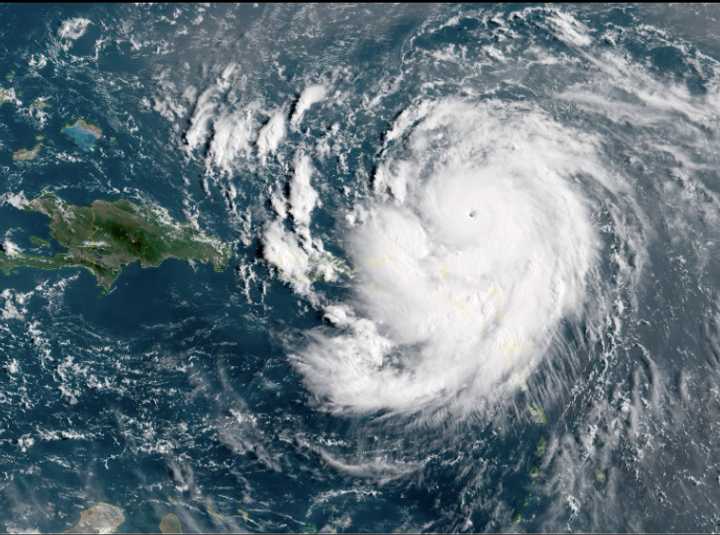
Early Saturday, Aug. 16, Hurricane Erin burst into a devastating Category 4 storm with a strength that astonished forecasters overnight.
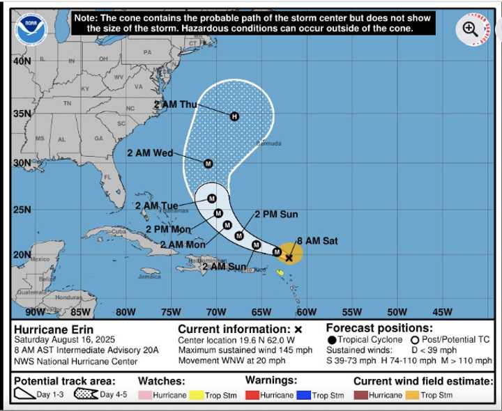
Check out the most recent information and forecasts for Hurricane Erin, which were made public by the National Hurricane Center on Saturday morning, August 16.
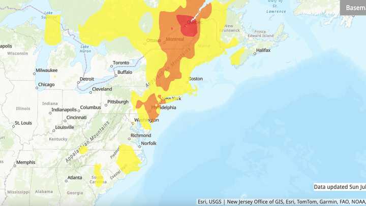
An analysis of the regions that Eric predicts will have the highest steering winds from Sunday, August 17 through Tuesday, August 19.
An overview of Erin’s anticipated trajectory through Friday, August 22.
With its outer bands already battering the Caribbean with torrential rain and strong winds, and its sights set on Bermuda and the US East Coast in the coming days, it churned just northeast of the Leeward Islands, unleashing gusts of 130 mph.
Erin is now the first significant hurricane of the 2025 Atlantic season due to its rapid development, according to the National Hurricane Center’s most recent advisory.
Forecasters warn that as the storm moves north and northeast next week, dangerous rip currents, beach erosion, and rough surf will spread over the US East Coast and Bermuda, even if Erin is predicted to remain offshore.
Residents and beachgoers are being warned by authorities to remain vigilant since any alteration in Erin’s trajectory might have more immediate effects on the US mainland or the Bahamas.
Erin is traveling west-northwest across the open Atlantic as of Saturday morning, around 150 miles northeast of Anguilla.
The northern Leeward Islands, where tropical storm watches are in effect, are already being impacted by the storm’s vast wind field and outer rainbands, even if the storm’s core is predicted to stay offshore.
People from the Turks and Caicos to the Leeward Islands are bracing for locally severe rainfall of up to 7 inches in some places, which increases the potential of mudslides and flash floods, especially in hilly terrain.
Throughout the weekend and the beginning of next week, beaches are predicted to see severe rip currents and rough surf, with gusty gusts of 40 to 50 mph possible in the outer bands.
Erin is expected to move west of Bermuda sometime in the middle of the week, with isolated gusts of up to 100 mph and possible wind speeds of 60 to 80 mph. Localized power outages could result from these winds’ potential to bring down power wires and trees. Additionally, Bermuda might see two to four inches of rain, with some regions perhaps receiving up to eight inches.
Erin is being actively watched by the National Hurricane Center, which advises everyone in the Caribbean, Bermuda, and along the East Coast to keep an eye on developments. Visit hurricanes.gov for the most recent information.
For updates, return to Daily Voice.