Here’s Timing For Separate Weekend Storm Systems
Parts of the East Coast weekend will be dampened by separate rounds of thunderstorms.
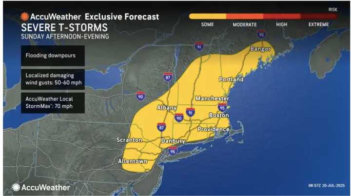
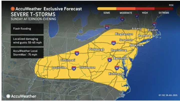
The areas highlighted in yellow will see the highest levels of activity over the weekend on Sunday, July 27.
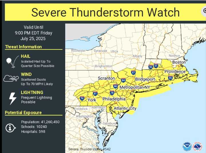
Thunderstorms are expected to move from the Midwest into Pennsylvania, Virginia, West Virginia, and Maryland on Saturday, July 26.
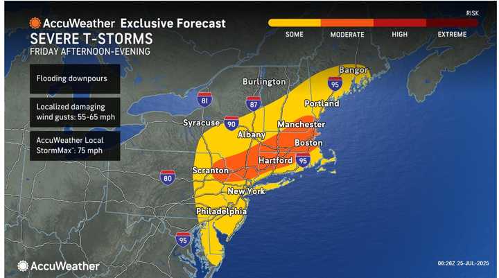
The most extensive activity will occur on Sunday, July 27, when storms could cause flash flooding and severe wind gusts that could affect regions from the mid-Atlantic to southwestern New England in the afternoon and evening.(Refer to AccuWeather’s first graphic above.)
Major highway traffic may slow down as a result of the storms, and major airports in Pittsburgh, Philadelphia, and New York City may have delays.
Thunderstorms are expected to move from the Midwest into Pennsylvania, Virginia, West Virginia, and Maryland on Saturday, July 26 from late afternoon into early evening. (Click the second picture up top.)
The National Weather Service warns that isolated flash floods could occur in those areas due to heavy rainfall. Winds can also cause damage.
Monday, July 28 through Wednesday, July 30 are predicted to see mostly sunny skies with daily highs in the 90s.
-
Previous article: Why Plugged-In Devices Are Dangerous During Storms: A Livestreamer Was Startled by Lightning While Playing Video Games
Previous article: Why Plugged-In Devices Are Dangerous During Storms: A Livestreamer Was Startled by Lightning While Playing Video Games
For updates, return to Daily Voice.