Hurricane Erin Turns North With Dangerous Surf, Rip Current Alerts Issued Throughout East Coast
As life-threatening surf and rip currents batter the East Coast on Wednesday, August 20, a huge, churning Hurricane Erin is making the Atlantic a dangerous place for beachgoers from Florida to Massachusetts, prompting urgent cautions to avoid the ocean.
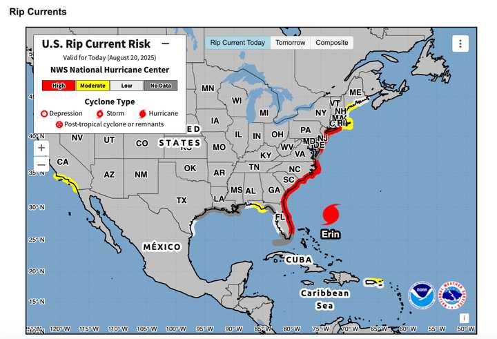
All over the East Coast, Erin will unleash rip currents and destructive surf.
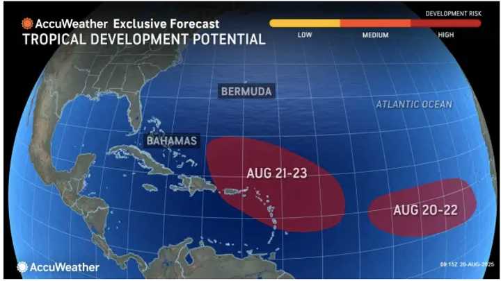
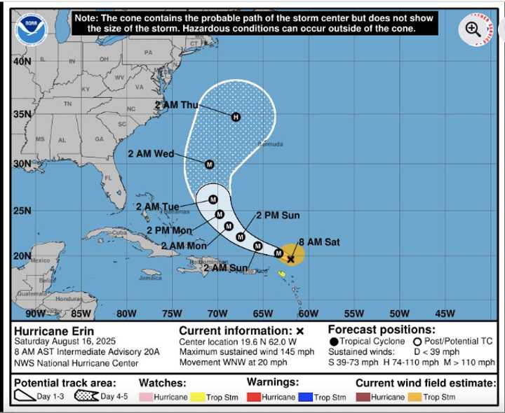
The National Hurricane Center provided the most recent information on Erin on Wednesday morning, August 20, including its expected trajectory and timeframe.
Erin’s wind forecasts for Tropical Storm Force.
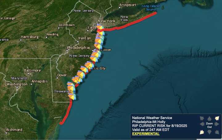
On Wednesday afternoon, August 20, soaking rain is predicted for the whole Northeast into the evening.
Because of Erin’s strong winds and massive size, which create dangerous conditions and pounding surf along 2,000 miles of shoreline, the National Hurricane Center has declared a high risk of rip currents for the majority of East Coast beaches through Thursday, Aug. 21.
The best counsel? The organization advised people to avoid the sea, stating that even skilled surfers and swimmers could be carried away by the unrelenting currents.
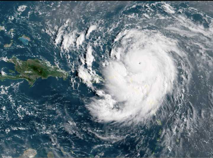
The hurricane center’s most recent advisory, released Wednesday morning, stated that while though Erin’s winds have decreased since it peaked as a Category 5 storm last weekend, the hurricane is still a powerful force.
According to AccuWeather Lead Hurricane Expert Alex DaSilva, “Hurricane Erin is producing a tremendous amount of wind and wave energy that will create hazardous beach conditions from Florida to New England.”
From late Wednesday afternoon through the evening, soaking rain is predicted across the Northeast.
According to AccuWeather, its enormous wind field is functioning as a gigantic plunger, producing waves of five to ten feet to travel from the Carolinas to New England and sending enormous swells onto the coast.
Waves could be 10 to 20 feet in some places, particularly along the beaches of Virginia and North Carolina. Near the storm’s center, open-ocean swells could get as high as 50 feet.
Though its effects will be felt far inland, Erin is expected to pass roughly 200 miles east of Cape Hatteras, North Carolina.
In eastern North Carolina, tropical storm force winds of 40 to 60 mph are predicted, with gusts as high as 40 mph likely as far north as southern New England.
In the most severely affected locations, coastal communities are at risk of localized floods, beach erosion, and storm surges of up to six feet.
Because circumstances could turn life-threatening through Saturday, Aug. 23, officials advise everyone near the coast to follow lifeguard and municipal authorities’ warnings.
For updates, return to Daily Voice.